The Accountability Gap
Access Can Be Arranged. Shared Measurement Usually Isn't.
Public agencies can and do work across property lines. What consistently seems to be missing is a shared system for measuring whether the connected landscape — public and private — is actually getting better.
Companion to The Boundary Problem — which documents the underlying case record. This piece analyzes the pattern.
The Finding
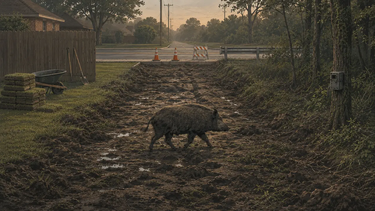
Wild pigs move through connected habitat, drainage, water, and food networks that cross property lines. Public authority, budgeting, contracting, and complaint reporting are usually organized and reported by parcel and jurisdiction instead. Agencies can and do obtain consent to work across those lines — but no comparable system necessarily follows the animals, or measures results, across the connected landscape.
It would be easy, and inaccurate, to say government simply "can't reach" private land. It can, and often does. USDA's Feral Swine Eradication and Control Pilot Program provided direct, no-cost control to more than 6,700 landowners on almost 9 million acres nationally between 2020 and 2024 — including 628 landowners on 517,397 acres of private property in Arkansas alone.
The better-supported finding is narrower and more useful:
Public programs can and do operate on private land, with consent, funding, and a recruitment mechanism. In the programs and jurisdictions reviewed for this piece, we found few documented efforts designed to assemble numerous small, separately-owned residential parcels — backyards, HOA common areas, drainage corridors — into one connected control and measurement area, the way large-acreage programs already do for farms and ranches. That's a finding about the record we reviewed, not a claim about every program in the country.
Coexistence between a funded public program and unresolved nearby private complaints doesn't, by itself, prove the program failed or that animals moved in any particular direction. What it does show, in the records reviewed here: no designated data steward or joint reporting system was found to be responsible for publishing whether complaints, damage, or wild-pig activity actually declined across the connected public-private landscape. The scientific literature independently documents the measurement half of this problem: a 2024 systematic review of 209 wild-pig damage studies found 84% were purely qualitative, with inconsistent measurement preventing comparison across programs, and its authors called for standardizing damage measures alongside population monitoring. That review establishes the measurement gap; the governance question — who should be responsible for reporting across boundaries — is this piece's own finding, not theirs.
Part One: The Record
Presented in three tiers, since combining them as identical "cases" invites a fair methodological objection.
Tier 1 — Place-based longitudinal cases
Tier 1Arlington, Tarrant County
Arlington has trapped at River Legacy Park, the city landfill, and Parkway North since at least 2010. Arlington Animal Services officer David Davis, who heads the trapping program, reported 25 pigs trapped in October 2023 — described as high for that early in a season that typically runs October through March. Pigs travel the Trinity River corridor and make stops in neighborhoods like Parkway North, where residents report recurring yard damage year after year. What the record documents is sustained municipal effort alongside sustained neighborhood exposure; no before-and-after outcome series linking the two was located.
- KERA News (Nov. 13, 2023)www.keranews.org/environment-nature/2023-11-13/its-going-to-be-a-forever-thing-north-arlington-neighborhood-battles-yearly-visits-by-feral-hogs
- Dallas Morning News (Feb. 11, 2022)www.dallasnews.com/news/2022/02/11/feral-hogs-tearing-up-yards-in-arlington-neighborhood/
Tier 1Austin, Travis County
Austin Water's Wildland Conservation Division has worked to reduce hog numbers on Water Quality Protection Lands and the Balcones Canyonlands Preserve for over a decade. As of 2020, the department reported six active traps at the preserve and roughly 75 hogs removed from the land annually. Austin Water also states the boundary problem plainly: when hogs migrate from an area with an active trap into an area without a management program, they reproduce and return.
The most telling detail is operational. Austin Water said it cannot operate traps near the Lakewood neighborhood specifically, because the area sits close to Forest Ridge Trail — its protocol requires that land used for hog management be locked and nearby users notified, and when the trail was closed previously, people trespassed anyway. That's a public agency describing, in its own words, a concrete reason the residential edge is harder to reach than the interior of the same managed land.
- KXAN Austin (Oct. 2020)www.kxan.com/news/local/austin/concerns-about-feral-hog-encounters-sparked-by-austin-animal-protection-officers-injury/
Tier 1Addicks/Barker Reservoirs, Harris County
Precinct 3 ran a funded trapping program here in 2014; USACE separately launched an annual trapping-permit program here in August 2019. (These are two documented programs at this location, not a demonstrated continuous effort across the whole span.) Green Trails, adjacent to these same reservoirs, was still reporting active damage in July 2026.
- Houston Chronicle (2014)www.houstonchronicle.com/news/houston-texas/houston/article/Feral-hog-capture-program-aims-to-protect-5792140.php
- USACE Galveston District (Aug. 2019)www.swg.usace.army.mil/Media/News-Releases/Article/1927655/addicks-and-barker-reservoirs-launch-feral-hog-management-program-and-permit-dr/
- FOX 26 Houston (Jul 2026)www.fox26houston.com/news/hundreds-wild-hogs-from-george-bush-park-creating-havoc-westside-neighborhood
Tier 2 — What accountable measurement looks like
Tier 2San Diego County, California
Beginning in 2009, eleven government, tribal, and water-district land managers formed an all-lands eradication partnership. USDA researchers used 285 cameras and a dynamic occupancy model to measure changes in site usage across the removal program (June 2014–January 2016), publishing the results in Biological Invasions. Site usage declined over time, and estimated site-level non-usage increased in response to removal efforts.
Two honest caveats on what this is: the camera data were collected as part of the management program itself, by USDA APHIS Wildlife Services personnel — the same agency conducting removals — so this is structured longitudinal outcome monitoring, not institutionally independent evaluation. And it tracks change during management rather than against a clean pre-program baseline. Even with both caveats, it's meaningfully more than a removal count, and it remains the clearest published outcome measure found in this review for a mixed public/urban setting.
- Biological Invasions (Springer)link.springer.com/article/10.1007/s10530-017-1579-x
- San Diego Management and Monitoring Programwww.sdmmp.com/
Tier 2USDA's Feral Swine pilot program — accountability including the parts that didn't work
The FSCP's final report doesn't just publish removal counts. It reports damage measures, landowner surveys, population estimates, and null or mixed findings alongside the successes: Arkansas documented pasture damage falling from 17% to below 1%, while also noting the limits of survey-based estimation. Alabama's own lessons-learned section recommends against watershed boundaries for program eligibility, on the grounds that county lines were easier for the public to understand. That willingness to publish what didn't work, next to what did, is itself the accountability model — and it comes from a rural, agricultural landownership context quite different from a platted suburban subdivision, which is worth keeping in mind before assuming the results transfer.
- USDA FSCP Final Report (2025)www.nrcs.usda.gov/sites/default/files/2025-12/usda-feral-swine-eradication-control-pilot-pgm-final-report.pdf
Tier 3 — Administrative records and external analogues
Tier 3Two Harris County Precinct 4 agreements
Theodis Daniel (Legistar File 25-5974, filed 2025, through 2028) and Ricky DeMann (Legistar File 26-1953, approved March 2026, through 2031) document a standing, no-cost county trapping mechanism. Both are public records, verified directly against the Legistar system. Whether their designated sites sit directly adjacent to the Green Trails corridor specifically hasn't been confirmed against the underlying exhibits, so they're presented here as evidence of what the county authorizes and measures — not as two independent proof points of harm to one specific neighborhood.
- Harris County Legistar — File 26-1953harriscountytx.legistar.com/LegislationDetail.aspx?ID=7950645&GUID=A28022D3-4FF0-40E4-9632-5B26CE97A16B&FullText=1
Tier 3San Antonio — Friedrich Wilderness Park / Stonewall Estates
The city funds a trapping contract for Friedrich Park; the adjacent Stonewall Estates neighborhood has reported damage to numerous homes. Texas A&M's Jay Long: suburban management options are "severely limited," compared to a rancher with a thousand acres.
- KSAT (Nov. 2025)www.ksat.com/news/local/2025/11/14/are-feral-pigs-coming-to-a-neighborhood-near-you-texas-am-expert-weighs-potential-causes/
Tier 3Stonecrest / Arabia Mountain National Heritage Area, Georgia
Residents documented damage and a pooled-money private response; DeKalb Park Naturalist Jennifer McLaurin, working with DeKalb County and Parks Director Chris Bass, announced a six-month public trapping program at sites around the Heritage Area in the same period. (A separate June 2 educational workshop was run jointly by the City of Stonecrest and the DeKalb County Soil and Water Conservation District — a related but distinct effort from the trapping program itself.)
- Atlanta News First (Mar. 2026)www.atlantanewsfirst.com/2026/03/30/stonecrest-couple-says-feral-pigs-tore-up-yard-wooded-area-near-home/
- Arabia Mountain Alliancearabiaalliance.org/field-notes/stonecrest-feral-hog-workshop-recap-what-to-know/
Tier 3San Jose — Silver Creek Valley, California
The Santa Clara Valley Open Space Authority holds a three-year, $243,000 contract for hog management on its land; a named trapper attributes seasonal movement toward irrigated business-park landscaping to drying hills and stock ponds nearby. San Jose separately requires residents to pay for their own licensed trapper on private property.
- SFGATE (Jul. 2026)www.sfgate.com/local/article/wild-pigs-san-jose-22354354.php
Tier 3San Luis National Wildlife Refuge Complex, California — the mirror-image case
The Fish & Wildlife Service's own draft plan states that a lack of control on refuge land could reduce the effectiveness of a neighboring private landowner's own trapping efforts. This runs the boundary problem in the opposite direction: unmanaged public land undermining private control, not the reverse. It's presented here as a real, primary-sourced statement in a draft plan — not yet a confirmed operating outcome.
- U.S. Fish & Wildlife Service — Draft Feral Pig Management Planwww.fws.gov/sites/default/files/documents/san-luis-nwr-complex-feral-pig-draft-ea-508.pdf
Tier 3Edgewater, Florida — a genuine counterexample
A police-coordinated trapping program, using an FWC-approved trapper, removed more than 50 hogs in three months, moving traps as complaint areas shifted. The published reporting establishes police coordination clearly; it doesn't specify who paid the trapper, so this should be read as city-launched rather than confirmed city-funded until a contract or budget record is available. This is also a counterexample to one specific claim only — that municipalities only tell residents to hire someone privately — not to the broader measurement-gap point: 50 removals is an output, not evidence that damage, complaints, or the underlying population actually declined. Worth noting: at least one resident there was paying a private trapper out of pocket before the city program began.
- ClickOrlando/WKMG (Jul. 2026)www.clickorlando.com/news/local/2026/07/09/edgewater-residents-battle-feral-hog-invasion-city-traps-50-in-3-months/
- FOX 35 Orlandowww.fox35orlando.com/news/over-50-feral-hogs-trapped-edgewater-neighborhood-battle-is-far-from-over-officials-say
Part Two: The Visibility Trap
During drought, visible rooting damage on public land can decrease — less digging — while pigs simultaneously become more likely to seek food and water in residential landscapes and irrigated green space nearby. That pairing of observations is TPWD- and AgriLife-sourced. What it does not yet establish, on the currently available record, is that the same population measurably moves from one place to the other in a single tracked event.
The accurate way to state it:
Dry conditions can shift where the visible signs of a hog problem appear, at the same time creeks, drainage corridors, and irrigated space connect otherwise-separate parcels. Monitoring only the parcel where a trap sits — or only counting removals — can miss activity redistributing across that connected network. A quiet-looking public tract during drought is not, by itself, evidence that nearby exposure fell.
This is a plausible mechanism worth watching, not a demonstrated migration switch. It's also the reason a watershed or corridor view of the problem is useful — independent of who has legal authority to act on it.
Part Three: A Hybrid Model, Not a Single Fix
Lone Star Healthy Streams (TSSWCB + Texas A&M AgriLife) already organizes feral-hog and water-quality work around watersheds rather than county lines — including the Lake Houston Area Watersheds, spanning seven counties as one unit. That's an existing precedent that Texas already treats the watershed as a legitimate planning geography.
It is not, on its own, proof that watershed-based coordination solves the residential trapping gap — it's an education and technical-assistance program, not a demonstrated parcel-access or removal-outcome one. And USDA's own FSCP reporting includes an honest caution from its Alabama project: county lines, not watershed boundaries, made public communication and program eligibility easier for residents to understand.
The more defensible structure separates three different jobs rather than picking one boundary to replace all of them:
| Function | Best-suited unit |
|---|---|
| Ecological analysis and corridor mapping | Watershed / riparian network |
| Legal authority, budgeting, public communication | County / city / precinct |
| Field deployment and outcome measurement | A connected management zone spanning consenting parcels |
USDA's own FSCP final report independently arrives at close to this answer. Its own lessons-learned section recommends a shared metric — damage reduction, landowner satisfaction, and removals, credited across every participating agency — as the thing that "would encourage greater cooperation." Arkansas' project specifically found that trusted local technicians, not the federal agency directly, were what actually opened access to adjoining private parcels once one property owner saw results and told a neighbor.
That's an evidence-supported design hypothesis, not a proven model: one trusted local access point, a free or low-cost mechanism, and a shared outcome metric that credits every agency and landowner involved. Arkansas demonstrates the components work in a rural, large-acreage setting. Whether they transfer to fragmented suburban neighborhoods is exactly the thing nobody has measured yet.
What Accountable Measurement Would Actually Look Like
Identifying a measurement gap is only useful if you can say what would fill it. A minimum viable package, drawn from what the literature and the better programs already do:
| Measure | Why it matters |
|---|---|
| Complaints per 1,000 households per month | Normalizes for population and development growth |
| Newly damaged area, or estimated repair cost in a consistent valuation year | Damage, not just reports of damage |
| Camera detections or occupancy, adjusted for monitoring effort | Activity independent of who happens to call in |
| Removals per trap-night | Effort-adjusted operational output — a secondary measure, not the headline |
| Time until activity recurs after removal | Distinguishes a temporary dip from durable control |
| Results across the whole connected zone, not only at trap sites | The entire point of the boundary problem |
| A baseline period, repeat intervals, and a comparison area where feasible | Makes any observed change interpretable |
| Weather, season, irrigation, and outreach changes logged as covariates | Prevents misreading a reporting artifact as a real trend |
Three cautions that make this harder than it looks, and that any honest program should state up front: complaints aren't interchangeable with damage or abundance — a public-awareness campaign can raise complaint counts while activity falls. Drought can suppress visible rooting without reducing the number of pigs nearby. And a camera not detecting a pig is not proof of absence. Pairing standardized damage measures with population or activity estimates, as the 2024 review recommends, is what makes any of these numbers mean something.
A Practical Suburban Pilot
None of this requires a statewide program to test. A credible suburban pilot needs a defined zone, common rules, and a reporting plan committed to in advance:
- Define the zone before deployment. Map the public tracts, drainage and riparian corridors, HOA common areas, and willing residential parcels that together form one connected unit.
- Create one participation channel. A single trusted local coordinator collects consent and explains eligibility, so residents aren't left navigating three agencies to find out who can help.
- Establish a baseline. Record complaints, standardized damage, camera activity, weather, irrigation, and monitoring effort before removals begin.
- Track effort and outcomes separately. Publish removals and trap-nights, but make changes in damage, complaints, and activity the headline numbers.
- Report the whole zone. Don't publish success measured at trap sites alone if activity may simply have shifted to adjoining parcels.
- Publish null results. A pilot reporting no detectable improvement still produces useful evidence. A pilot reporting only removals doesn't answer the question at all.
The goal wouldn't be to promise eradication. It would be to find out whether coordinated access and shared measurement actually outperform the fragmented status quo — and to make that answer public either way.
What This Piece Does Not Claim
We have not found, and are not aware of, any published data proving that a specific public trapping program caused, worsened, or failed to prevent private-side hog damage. What the record above shows is that funded public programs and unresolved nearby private complaints have coexisted — sometimes for over a decade — in multiple, independently documented places, while almost nothing tracks whether the connected landscape between them is getting better. That is a sourced pattern. It is not proof that any one program failed, and it isn't presented as one. "Not found" means not located in the public record reviewed for this piece — not proof that no agency tracks this internally.
A Note on Method
This piece draws on public government records (Legistar filings, agency reports, draft federal plans), peer-reviewed literature, and news coverage with named sources. Records reviewed through August 23, 2026. It does not reflect direct outreach to the agencies named — statements here describe what appears in the public record, not a confirmed absence of unpublished internal data. Cases were included where a primary source was locatable and verifiable; candidate leads were excluded where the underlying claim couldn't be confirmed against one (two were dropped on that basis).
Two limits worth stating plainly rather than burying: this review was not a systematic census of every municipal or county hog program in the United States, and "outcome" here means a published measure of damage, complaints, or activity — as distinct from an output like a removal count. A reader should treat the negative findings as "not located in the records reviewed," which is a weaker and more honest claim than "does not exist."
Disclosure
Texas Hog Dispatch operates a dispatch platform that connects property owners with independent wildlife-abatement operators, and would stand to benefit commercially from wider adoption of coordinated, cross-property hog control. This piece is independently sourced and publicly documented; it is not sponsored or endorsed by any agency or organization discussed in it, and no agency named here has reviewed it.
Sources
- McKee, S.C., DeLay, N.D., Mooney, D.F., & Shwiff, S.A. (2025). "Externalities in wild pig damages on U.S. crop and livestock farms." PLOS ONE, 20(4), e0320316. doi.org/10.1371/journal.pone.0320316
(Cited as supporting evidence for the general spatial-externality principle — this study covers crop/livestock farms, not suburban neighborhoods directly.)
- VerCauteren, K.C., Pepin, K.M., Cook, S.M., McKee, S., Pagels, A., Kohen, K.J., Messer, I.A., Glow, M.P., & Snow, N.P. (2024). "What is known, unknown, and needed to be known about damage caused by wild pigs." Biological Invasions, 26, 1313–1325. doi.org/10.1007/s10530-024-03263-z
- USDA Feral Swine Eradication & Control Pilot Program Final Report (2025), NRCS/APHIS/Alabama Cooperative Extension/Texas A&M AgriLife. nrcs.usda.gov — FSCP final report (PDF)
- U.S. Fish & Wildlife Service, San Luis National Wildlife Refuge Complex Draft Feral Swine Management Plan (Feb. 2024). fws.gov — San Luis NWR draft plan (PDF)
- Texas State Soil and Water Conservation Board, Lone Star Healthy Streams program materials. tsswcb.texas.gov — Lone Star Healthy Streams
Add a Case or Correct This Analysis
Have a documented case that fits this pattern, or a correction to the analysis above? Send it to data@texashogdispatch.com with the location and its primary source, or use the report link below.